

Industry: Remote Sensing
Revolutionary Capabilities with new Advancements by AI and satellites
Experience a paradigm shift in Earth observation. Today's satellites capture images at unprecedented 30cm resolution, visiting any location daily. When combined with advanced AI, this technology reveals insights that were impossible just years ago - from precise crop health monitoring to real-time urban development tracking.
Remote Monitoring
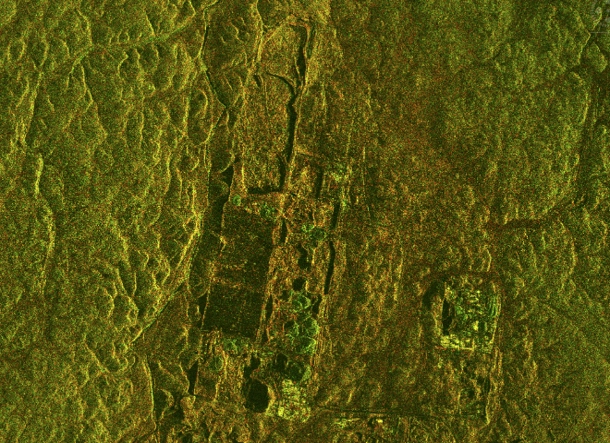
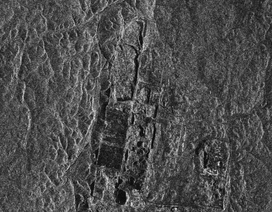
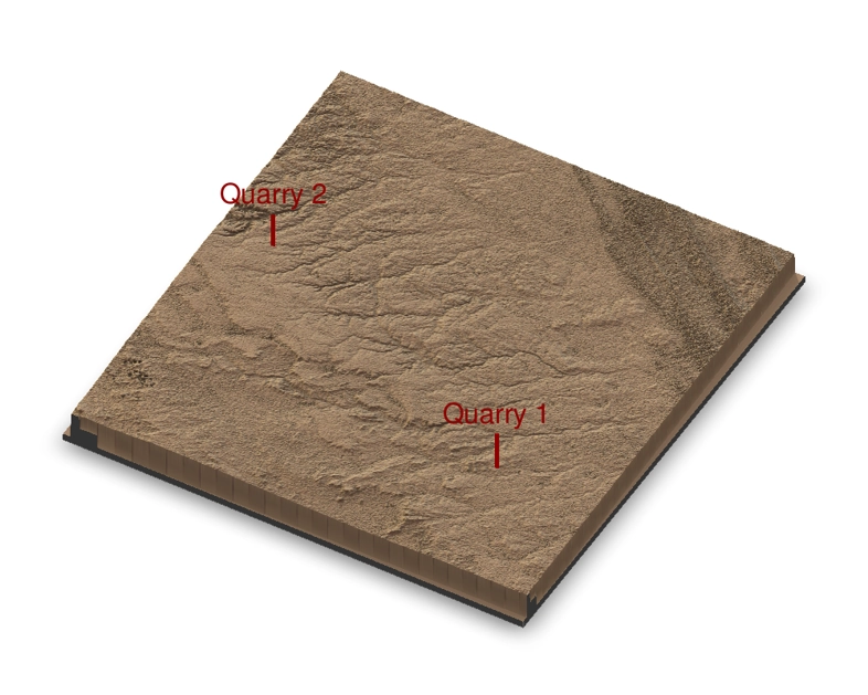
Advanced satellite imagery combined with AI analysis enables precise monitoring of remote locations around the world, such as quarries, docks, trading hubs and more, for terrain changes and/or even volumetric calculations. This technology helps operators track material extraction, detect subtle ground movements and measure stockpile volumes in real time, providing critical insights for operational efficiency and safety monitoring. It also enables companies trading on commodity exchanges to more quickly analyse producers of commodities such as iron, copper, coal, etc. in order to respond immediately to market disrupting actions.
Transform Operations with AI and Earth Observation
Modern remote sensing technology, combining high-resolution satellite imagery with AI analytics, is revolutionizing how industries monitor and manage their operations. With daily revisit rates and sub-meter resolution, our solutions provide unprecedented visibility into site changes, enabling data-driven decisions and automated monitoring at scale.
Get in TouchTransforming Industries
Agriculture Analysis
AI-powered satellite monitoring transforms farming operations. Real-time crop health assessment, yield prediction through machine learning models, and optimized resource allocation across vast agricultural areas enable precise farm management and production forecasting, driving data-driven decisions in agricultural businesses.
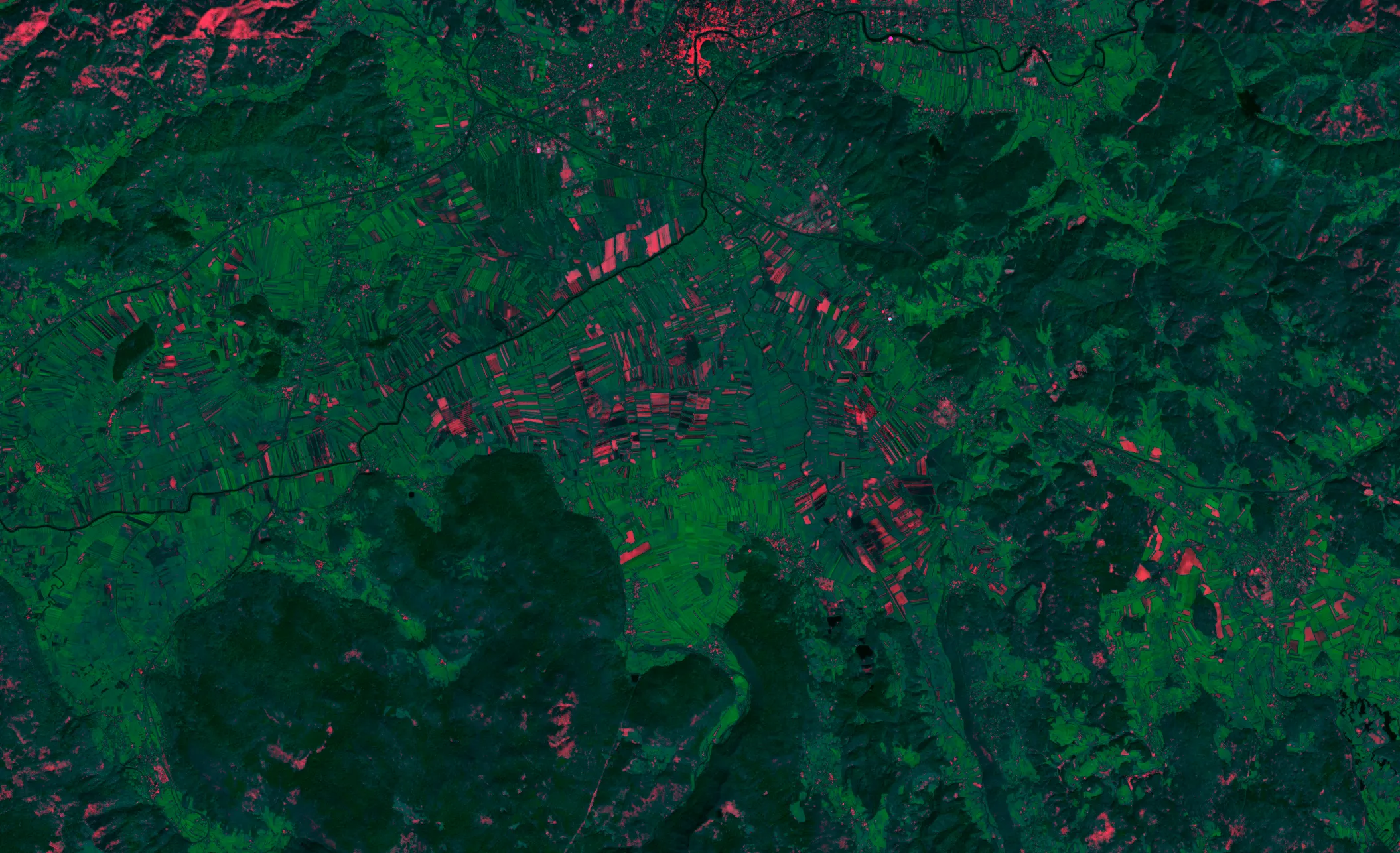
Satellite imagery showing automated crop health analysis with enhanced visualization of vegetation indices. Processing and analyzing by nAIxt Technologies, Data from Sentinel 2.
Natural Resource Exploration
Advanced remote sensing accelerates resource discovery and assessment. AI algorithms analyzing multispectral satellite data can identify mineral deposits, hydrocarbon indicators, and hydrothermal features with unprecedented accuracy. This technology drastically reduces exploration time and costs while minimizing environmental impact.
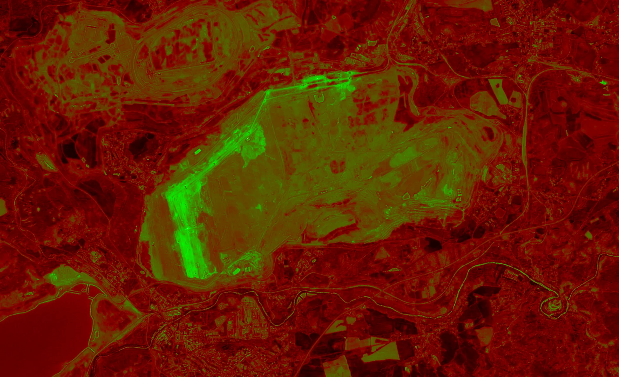
Multi-band satellite analysis revealing potential mineral deposits through spectral signature mapping. Processing and analyzing by nAIxt Technologies, Data from Sentinel 2.
Natural Disaster Intelligence
Modern satellite monitoring enables near real-time disaster insights. Immediate assessment of natural catastrophes, from flood extent mapping to wildfire spread tracking, provides critical intelligence for faster emergency response and more effective disaster management.
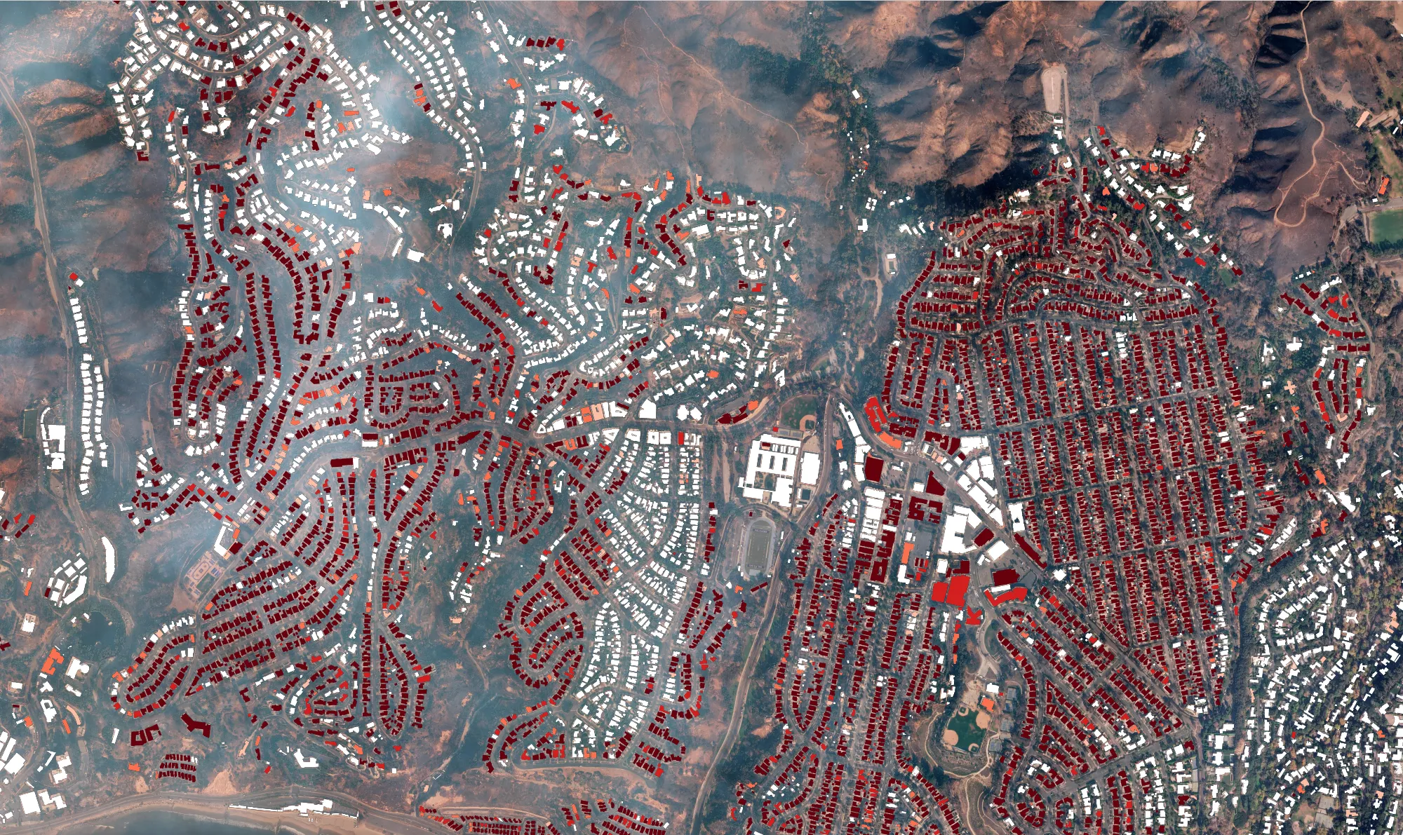
Post-disaster land Cover classification based on the OpenData from Maxar for the palisades fire.
Navigate the Future of AI-Powered Remote Sensing
Get expert guidance on leveraging satellite technology and AI for your strategic advantage. From implementation roadmaps to technology assessment, make informed decisions that drive business value.